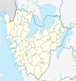
Karlsborg
Appearance
Karlsborg | |
|---|---|
 The garrison church in Karlsborg (9 June 2006) | |
| Coordinates: 58°32′N 14°31′E / 58.533°N 14.517°E | |
| Country | Sweden |
| Province | Västergötland |
| County | Västra Götaland County |
| Municipality | Karlsborg Municipality |
| Area | |
| • Total | 5.40 km2 (2.08 sq mi) |
| Population (31 December 2010)[1] | |
| • Total | 3,551 |
| • Density | 657/km2 (1,700/sq mi) |
| Time zone | UTC+1 (CET) |
| • Summer (DST) | UTC+2 (CEST) |
Karlsborg (Swedish: [kaɭsˈbɔrj], outdatedly [ˈkɑ̂ːɭsbɔrj])[2] is a locality and the seat of Karlsborg Municipality, Västra Götaland County, Sweden. It had 3,551 inhabitants in 2010.[1] This garrison town lies at the shore of lake Vättern in Västergötland.
History
[edit]The town of Karlsborg was established and grew due to the construction of Karlsborg Fortress, during the 19th century. According to the principles of a central defense, the fortress was designated as the reserve capital of Sweden in the event of war.
References
[edit]Wikimedia Commons has media related to Karlsborg.
- ^ a b c "Tätorternas landareal, folkmängd och invånare per km2 2005 och 2010" (in Swedish). Statistics Sweden. 14 December 2011. Archived from the original on 27 January 2012. Retrieved 10 January 2012.
- ^ Jöran Sahlgren; Gösta Bergman (1979). Svenska ortnamn med uttalsuppgifter (in Swedish). p. 13.


