Győr–Moson–Sopron County
Győr–Moson–Sopron County
Győr-Moson-Sopron vármegye | |
|---|---|
County | |
|
Descending, from top: Pannonhalma Archabbey, View of Lake Neusiedl in Fertőrákos, and Castle of Győr | |
 Győr-Moson-Sopron County within Hungary | |
| Country | Hungary |
| Region | Western Transdanubia |
| County seat | Győr |
| Districts | |
| Government | |
| • President of the General Assembly | Zoltán Németh (Fidesz-KDNP) |
| Area | |
| • Total | 4,208.05 km2 (1,624.74 sq mi) |
| • Rank | 13th in Hungary |
| Population (2018) | |
| • Total | 461,618[1] |
| • Rank | 6th in Hungary |
| GDP | |
| • Total | HUF 2,236 billion €7.182 billion (2016) |
| Postal code | 90xx – 94xx |
| Area code(s) | (+36) 96, 99 |
| ISO 3166 code | HU-GS |
| Website | www |
Győr–Moson–Sopron (Hungarian: Győr-Moson-Sopron vármegye, pronounced [ˈɟøːr ˈmoʃon ˈʃopron ˈvaːrmɛɟɛ]; German: Komitat Raab-Wieselburg-Ödenburg; Slovak: Rábsko-mošonsko-šopronská župa) is an administrative county (comitatus or vármegye) in north-western Hungary, on the border with Slovakia (Bratislava region, Nitra region and Trnava region) and Austria (Burgenland). It shares borders with the Hungarian counties Komárom–Esztergom, Veszprém and Vas. The capital of Győr–Moson–Sopron county is Győr. The county is a part of the Centrope project.
History
[edit]Győr–Sopron county was created in 1950 from two counties: Győr–Moson and Sopron. Though formed as a result of the general Communist administrative reform of that year, it is the long-term result of the impact of earlier border changes on Hungary's western counties. In 1921 the counties of Moson and Sopron were each divided in two, with their western districts together forming the northern half of the Austrian province of Burgenland. Between 1921 and 1945, Győr and Moson became part of the "provisionally and administratively unified counties of Győr–Moson–Pozsony", renamed after 1945 as simply Győr-Moson. In 1947 the borders of this county were modified when Hungary lost three villages in the far north of Győr–Moson to Czechoslovakia as a consequence of the Hungarian peace treaty signed in that year. Though Győr is the capital, there is a strong rivalry between it and Sopron, historically an important cultural centre on its own right. The county also contains Hegyeshalom, Hungary's busiest international land border crossing point. In 1990 it was officially renamed to Győr–Moson–Sopron county.
Geography
[edit]This section needs expansion. You can help by adding to it. (February 2023) |
Demographics
[edit]Religion in Győr–Moson–Sopron County (2022 census – of those who declared their religion (60.6%))
Győr-Moson-Sopron is the only county in Hungary whose population has been increasing[when?] according to the Központi Statisztikai Hivatal (KSH). The population density[when?] was 108/km2.
| Year | Pop. | ±% |
|---|---|---|
| 1870 | 263,145 | — |
| 1880 | 279,365 | +6.2% |
| 1890 | 294,118 | +5.3% |
| 1900 | 320,355 | +8.9% |
| 1910 | 335,868 | +4.8% |
| 1920 | 355,272 | +5.8% |
| 1930 | 371,825 | +4.7% |
| 1941 | 389,079 | +4.6% |
| 1949 | 374,987 | −3.6% |
| 1960 | 401,861 | +7.2% |
| 1970 | 414,457 | +3.1% |
| 1980 | 437,857 | +5.6% |
| 1990 | 432,126 | −1.3% |
| 2001 | 438,773 | +1.5% |
| 2011 | 447,985 | +2.1% |
| 2021 | 465,945 | +4.0% |
| Source: [3][4] | ||
Ethnicity
[edit]Besides the Hungarian majority, the main minorities are the Germans (approx. 5,000), Roma (3,500), Croats (3,000) and Slovaks (1,500).
| Ethnic groups (2011 census):[5] | |
|---|---|
| Total population | 447,985 |
| Identified themselves | 395,505 |
| Hungarians | 380,282 (96.15%) |
| Germans | 5,145 (1.30%) |
| Others and undefinable[clarification needed] | 10,078 (2.55%) |
| Undeclared | Approx. 63,000 [doesn't balance] |
Ethnic composition according to the KSH
| Ethnicity in 2018 | % of the county |
|---|---|
| Hungarians | 94% |
| Germans | 3.5% |
| Gypsies | 0.4% |
| Others | 1.1% |
Ethnicities in Győr-Moson-Sopron County (2018 census, KSH)
Religion
[edit]Religious adherence in the county according to 2011 census:[6]
| Roman Catholic | 243,196 |
| Greek Catholic | 1,066 |
| Total Catholic | 244,355 |
| Evangelical | 21,062 |
| Reformed | 14,741 |
| Other religions | 4,263 |
| Non-religious | 41,179 |
| Atheist | 4,683 |
| Undeclared | 117,702 |
Regional structure
[edit]
| No. | English and Hungarian names |
Area (km2) |
Population (2011) |
Density (pop./km2) |
Seat | No. of municipalities |
| 1 | Csorna District Csornai járás |
579.76 | 32,970 | 57 | Csorna | 33 |
| 2 | Győr District Győri járás |
903.40 | 190,146 | 210 | Győr | 35 |
| 3 | Kapuvár District Kapuvári járás |
372.14 | 23,778 | 64 | Kapuvár | 19 |
| 4 | Mosonmagyaróvár District Mosonmagyaróvári járás |
899.95 | 72,609 | 81 | Mosonmagyaróvár | 26 |
| 5 | Pannonhalma District Pannonhalmi járás |
312.34 | 15,227 | 49 | Pannonhalma | 17 |
| 6 | Sopron District Soproni járás |
867.71 | 98,841 | 114 | Sopron | 39 |
| 7 | Tét District Téti járás |
272.64 | 14,414 | 53 | Tét | 14 |
| Győr-Moson-Sopron County | 4,208.05 | 452,638 | 109 | Győr | 183 | |
|---|---|---|---|---|---|---|
Politics
[edit]County Assembly
[edit]The Győr-Moson-Sopron County Council, elected at the 2014 local government elections, is made up of 21 counselors, with the following party composition:[7]
| Party | Seats | Current County Assembly | ||||||||||||||
|---|---|---|---|---|---|---|---|---|---|---|---|---|---|---|---|---|
| Fidesz-KDNP | 14 | |||||||||||||||
| Movement for a Better Hungary (Jobbik) | 4 | |||||||||||||||
| Hungarian Socialist Party (MSZP) | 2 | |||||||||||||||
| Democratic Coalition (DK) | 1 | |||||||||||||||
Presidents of the County Assembly
[edit]| President[8] | Terminus |
|---|---|
| Zoltán Németh (Fidesz-KDNP) | 2014– |
Members of the National Assembly
[edit]The following members elected of the National Assembly during the 2022 parliamentary election:[9]
Municipalities
[edit]Győr-Moson-Sopron County has 2 urban counties, 10 towns, 4 large villages and 167 villages.
- Cities with county rights
(ordered by population, as of 2011 census)
- Towns
- Mosonmagyaróvár (32,004)
- Csorna (10,558)
- Kapuvár (10,495)
- Jánossomorja (5,921)
- Tét (3,954)
- Fertőszentmiklós (3,818)
- Pannonhalma (3,691)
- Fertőd (3,261)
- Lébény (3,156)
- Beled (2,633)
- Villages
- Abda
- Acsalag
- Agyagosszergény
- Ágfalva
- Árpás
- Ásványráró
- Babót
- Bágyogszovát
- Bakonygyirót
- Bakonypéterd
- Bakonyszentlászló
- Barbacs
- Bezenye
- Bezi
- Bodonhely
- Bogyoszló
- Börcs
- Bőny
- Bősárkány

- Cakóháza
- Cirák
- Csáfordjánosfa
- Csapod
- Csér
- Csikvánd
- Darnózseli
- Dénesfa
- Dör
- Dunakiliti
- Dunaremete
- Dunaszeg
- Dunaszentpál
- Dunasziget
- Ebergőc
- Edve
- Egyed
- Egyházasfalu
- Enese
- Écs
- Farád
- Fehértó
- Feketeerdő
- Felpéc
- Fenyőfő
- Fertőboz
- Fertőendréd
- Fertőhomok
- Fertőrákos
- Fertőszéplak
- Gönyű
- Gyalóka
- Gyarmat
- Gyóró
- Gyömöre
- Győrasszonyfa
- Győrság
- Győrladamér
- Győrszemere
- Győrsövényház
- Győrzámoly
- Győrújbarát
- Győrújfalu
- Halászi
- Harka
- Hegyeshalom

- Hegykő
- Hédervár
- Hidegség
- Himod
- Hövej
- Ikrény
- Iván
- Jobaháza
- Kajárpéc
- Károlyháza
- Kimle
- Kisbabot
- Kisbajcs
- Kisbodak
- Kisfalud
- Koroncó
- Kóny
- Kópháza
- Kunsziget
- Lázi
- Levél
- Lipót
- Lövő
- Maglóca
- Magyarkeresztúr
- Máriakálnok
- Markotabödöge
- Mecsér
- Mérges
- Mezőörs
- Mihályi
- Mosonszentmiklós
- Mosonszolnok
- Mórichida
- Nagybajcs
- Nagycenk

- Nagylózs
- Nagyszentjános
- Nemeskér
- Nyalka
- Nyúl
- Osli
- Öttevény
- Páli
- Pásztori
- Pázmándfalu
- Pereszteg
- Petőháza
- Pér
- Pinnye
- Potyond
- Pusztacsalád
- Püski
- Rajka
- Ravazd
- Rábacsanak
- Rábacsécsény
- Rábakecöl
- Rábapatona
- Rábapordány
- Rábasebes
- Rábaszentandrás
- Rábaszentmihály
- Rábaszentmiklós
- Rábatamási
- Rábcakapi
- Répceszemere
- Répcevis
- Rétalap
- Röjtökmuzsaj
- Románd
- Sarród
- Sikátor
- Sobor
- Sokorópátka
- Sopronhorpács
- Sopronkövesd
- Sopronköhida
- Sopronnémeti
- Szakony
- Szany

- Szárföld
- Szerecseny
- Szil
- Szilsárkány
- Táp
- Tápszentmiklós
- Tarjánpuszta
- Tárnokréti
- Tényő
- Töltéstava
- Und
- Újkér
- Újrónafő
- Vadosfa
- Vág
- Vámosszabadi
- Várbalog
- Vásárosfalu
- Veszkény
- Veszprémvarsány
- Vének
- Vitnyéd
- Völcsej
- Zsebeháza
- Zsira
![]() municipalities are large villages.
municipalities are large villages.
Gallery
[edit]-
Győr, the capital of the county
-
Fire tower in Sopron
-
Eszterháza, the Hungarian Versailles
-
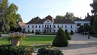
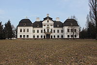
Széchenyi Mansion in Nagycenk
-
Gyülevizy-Pejacsevich Mansion in Zsira
-
Khuen-Héderváry Mansion in Hédervár
International relations
[edit]Győr-Moson-Sopron County has a partnership relationship with:[10]
|
|
References
[edit]- ^ nepesseg.com, population data of Hungarian settlements
- ^ Regions and Cities > Regional Statistics > Regional Economy > Regional GDP per Capita, OECD.Stats. Accessed on 16 November 2018.
- ^ népesség.com, "Pest megye népessége 1870-2015"
- ^ "Census database - Hungarian Central Statistical Office".
- ^ 1.1.6. A népesség anyanyelv, nemzetiség és nemek szerint – Frissítve: 2013.04.17.; Hungarian Central Statistical Office (in Hungarian)
- ^ 2011. ÉVI NÉPSZÁMLÁLÁS, 3. Területi adatok, 3.8 Győr-Moson-Sopron megye, (in Hungarian) [1]
- ^ Közgyűlés tagjai, (in Hungarian) [2]
- ^ Önkormányzati választások eredményei (in Hungarian)
- ^ "Győr-Moson-Sopron megye parlamenti képviselői (Parlamenti Információs Rendszer 2022-)" (in Hungarian). Hungarian National Assembly.
- ^ "Nemzetközi kapcsolatok (Győr-Moson-Sopron megye)". Archived from the original on 2021-03-08. Retrieved 2016-10-19.
External links
[edit]- Official site (in Hungarian and English)
- Kisalföld (kisalfold.hu) – The county portal
- Hungary at GeoHive


