Herne Hill, Victoria
Appearance
| Herne Hill Geelong, Victoria | |||||||||||||||
|---|---|---|---|---|---|---|---|---|---|---|---|---|---|---|---|
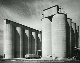
 Cement storage silos | |||||||||||||||
 | |||||||||||||||
| Coordinates | 38°07′58″S 144°19′50″E / 38.1329°S 144.3305°E | ||||||||||||||
| Population | 3,413 (2016 census)[1] | ||||||||||||||
| Postcode(s) | 3218 | ||||||||||||||
| LGA(s) | City of Greater Geelong | ||||||||||||||
| State electorate(s) | Geelong | ||||||||||||||
| Federal division(s) | Corio | ||||||||||||||
| |||||||||||||||
Herne Hill is a residential suburb of Geelong, Victoria, Australia. At the 2016 census, Herne Hill had a population of 3,413.[1] It is in the federal Division of Corio, and its postcode is 3218.
The former Geelong Protestant and Orphan Asylum and common school was built in 1855 - one of the first four orphanages set up in Victoria during the 1850s.
The orphan asylum site was acquired by Portland Cement in 1933.[2]
Herne Hill's suburban growth came after World War II.
The State primary and Catholic primary schools opened in 1954 and 1955, and a State technical school opened in 1954. The Catholic Brigidine Sisters opened a convent and Clonard College in 1956.[3]
Heritage listed sites
[edit]- "Karoomba" - 48 Heytesbury Street [4]
References
[edit]- ^ a b Australian Bureau of Statistics (27 June 2017). "Herne Hill (State Suburb)". 2016 Census QuickStats. Retrieved 16 November 2017.
- ^ "VHD". vhd.heritagecouncil.vic.gov.au. Retrieved 21 November 2018.
- ^ "Herne Hill | Victorian Places". www.victorianplaces.com.au. Retrieved 21 November 2018.
- ^ "VHD". vhd.heritagecouncil.vic.gov.au. Retrieved 22 November 2018.


